Flycam technology is applied in building 3D models of works and objects and applying it in the development of high-rise buildings, topographic surveys, traffic indications or measuring, surveying and calculating bronze statues. , …
Mục lục
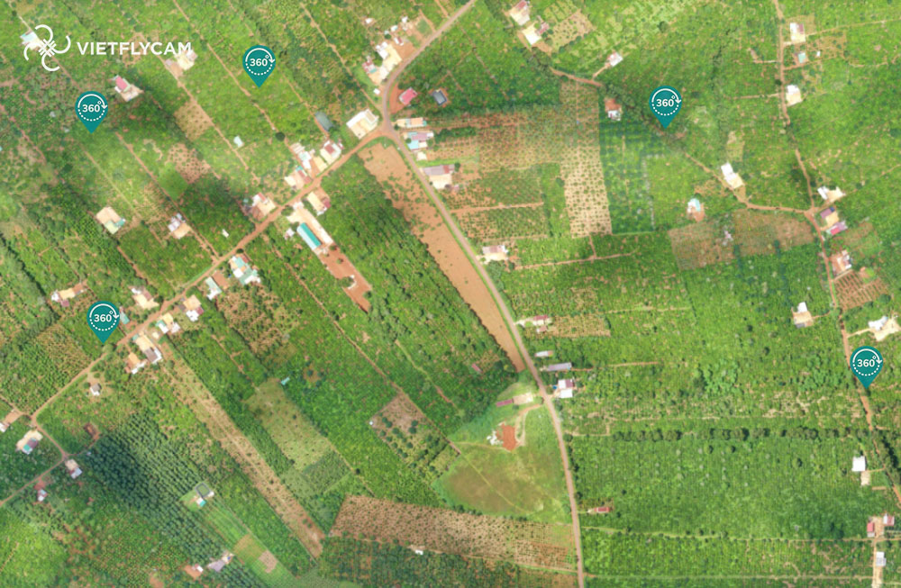
Flight service scanning 2D, 3D terrain survey
Reference project: SimeXco Buon Ma Thuot
Experience the project here: CLICK HERE
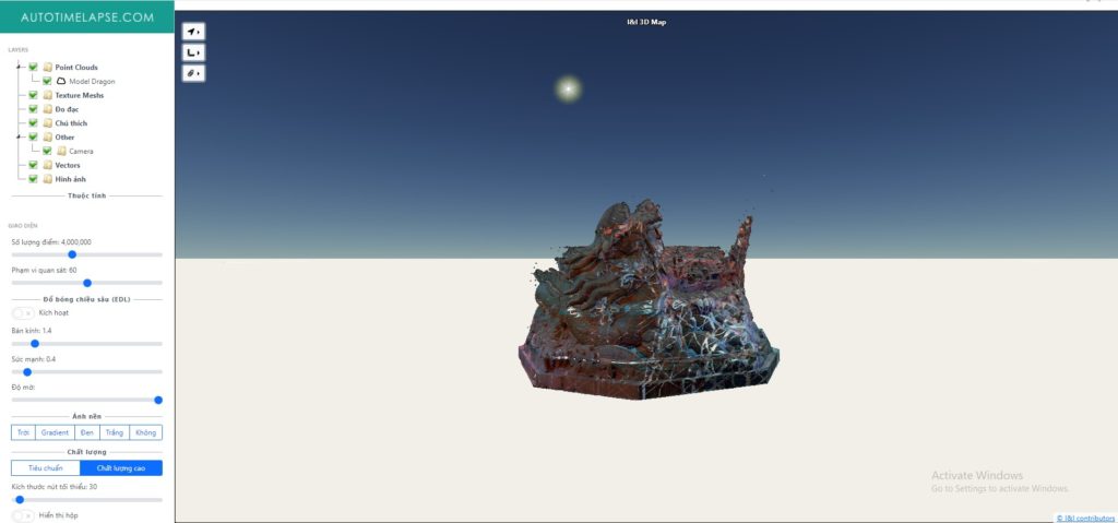
Flight service to scan 2D, 3D volumetric homography
Laser scanning and using Flycam to help build 3D models of large bronze statues accurately
Calculate volume, surface area and related parameters accurately and do it online. This ensures objectivity for the person performing the work and the project investor.
Experience the project here: CLICK HERE
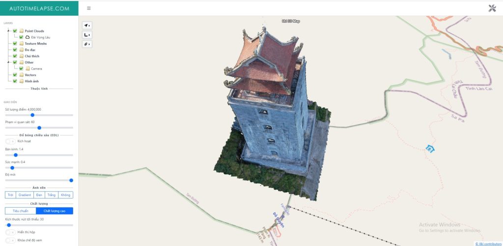
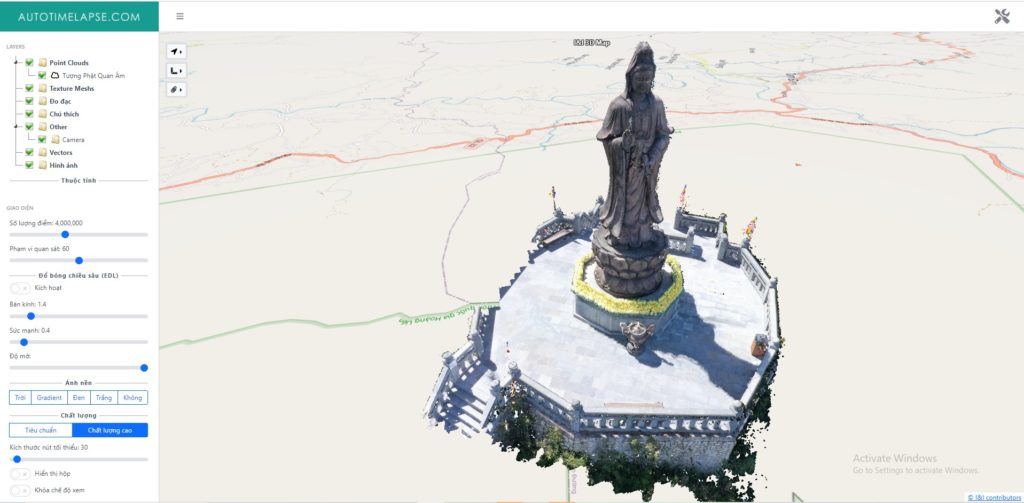
2D, 3D scanning flight service in building current status models of architectural works
Reference project: Scanning Fansipan Sapa project
Experience the project here: CLICK HERE
Fansipan – Van Son Tra Quan
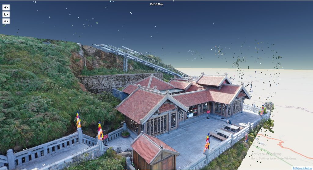
Fasipan – Gaze Tower
Fansipan – Guan Yin Buddha Statue
Reasons to use 2D and 3D Scanning Flight Service at Tracdiaso.com
High applicability:
Nowadays, not only architectural works but almost every need can be handled by 3D scanning. You can apply it in the development of high-rise buildings, topographic surveys, traffic indications or measuring, surveying, calculating bronze statues, …
Accuracy – Cost of Implementation – Time
Small calculation error: It can be said that there is currently no method that can handle this problem better than 3D scanning of works from above with a flycam. This method can handle works of wide scale, depth and comprehensiveness.
Reasonable cost: Although this is a new method, the cost is minimized compared to scanning works by traditional methods. Because the construction units are trying to minimize unnecessary costs. Therefore, you are completely assured of the cost.
Fast construction: Returning results to customers, construction parties only take 1 to 5 days to complete and execute. Especially, for projects with a moderate area, this time is shortened to the maximum.
High Image Resolution: This method allows projects to be modeled in 3D with the best resolution. Most of the exported files are viewable/readable by all features, except in the case of features covered by land cover.
Handling on all terrains:
The advantage of 3D Scan is that it is independent of environmental and topographic factors. Therefore, even complex jobs can be handled through this form.
No need for too much labor: Perhaps this is also the strength of this method because it does not take too much labor. This is already a machine that replaces humans and works efficiently.
Limit exposure to toxic environments: This is also a prominent advantage of this method. For high-risk projects, 3D scanning by drone is the most suitable form.
With experience in conducting topographic surveys, scanning hundreds of architectural works and construction works from North to South, Tracdiaso.com is confident in digital surveying solutions using UAV technology.
See more: Online geodesy in digital data storage and display
The only online surveying platform deployed in Vietnam.
Price list for data storage and analysis See details at THIS
Contact us to get a price list for surveying architectural works
Contact: 0917111392, 0869191996
Address: Building D8, Hanoi University of Science and Technology, Tran Dai Nghia, Hanoi, Vietnam
Email: Vietflycam1102@gmail.com
Giải pháp Trắc địa số toàn diệntại Tracdiaso.com
Hotline: 0917111392 - 0869191996
Địa chỉ: Tòa nhà D8, Đại học Bách Khoa Hà Nội, Trần Đại Nghĩa, Hà Nội, Việt Nam
Email: Vietflycam1102@gmail.com
Youtube: https://www.youtube.com/channel/UCgRFxKxd2vt5gn_mbS1sJgA