Tracdiaso.com
  • New age comprehensive geodetic solution ACCURATE - FAST - COST-EFFECTIVE
  • Professional topographic survey, mapping by UAV (Drone) technology
  • Preeminent tool in cadastral work, construction, zoning, heritage conservation,...
  • solution

    A digital surveying service brings

    • Edit topographic maps at 1/500, 1/2000, and 1/5000
    • Establish current status maps for zoning, topographical maps, and maps for research and farming.
    • Digitalize the map and display the map online on 2D and 3D platforms to aid in the visual assessment of the current status of the survey area.
    • Edit detailed topographical maps for appraisal and licensing at state agencies, authorities, and site clearance
    • 2D products are photos taken in high definition, detailing the current state of the survey area.
    • The length and area measurement tool integrated online helps produce statistics on the size of the features and accurately measure the parameters on the map.
    • An effective tool for zoning, compensation, or inspection of land use status.
    • Integrate the base map layers of Google, Apple, Bing, etc. to determine the exact location of the area on the international map.
    • The 3D product accurately records every angle, topographical features and the topography of the survey area, including houses, trees, power lines, architectures…
    • 3D materials for site assessment, design ideas and remote survey of areas with complex terrain.
    • Customers can easily access and measure all parameters of any location via computer or smartphone.
    • Integrate 3D products with base maps of all digital map firms in the world

    .

    • The 3D product accurately records every angle, topographical features and the topography of the survey area, including houses, trees, power lines, architectures…
    • 3D materials for site assessment, design ideas and remote survey of areas with complex terrain.
    • Customers can easily access and measure all parameters of any location via computer or smartphone.
    • Integrate 3D products with base maps of all digital map firms in the world
    • Processing Panorama images, VR360 Video helps present a visual perspective and allows customers to actively interact.
    • VR360 points are attached on 2D map according to the located position, helping interaction and visual monitoring of the survey areas.
    • Draw a 3D perspective of the building on VR360 to show the beauty and caliber of the project after completion.
    • Create virtual tours for buildings, factories, and model houses.
    • After the scanning process, the data is collected and transferred to the analysis system.
    • Measure and calculate the distance, surface area, terrain volume, and visualize the backfill, site clearance, and topographic survey.
    • Measure, compare among data from previous surveys that have been stored in the online data warehouse.
    • Edit the terrain to remove inaccuracies and obstacles that cause bad data.
    • Automatically store, update, and analyze raw data of field measurements
    • Compare survey results with actual progress; evaluate labour productivity of human resources
    • Track progress by comparing single points, sections, and volumes.
    • During the comparison, if an abnormality is detected, it is necessary to conduct a detailed geodetic survey and change the construction plan accordingly.
    Benefit

    Optimize the customer experience

    Exceptional speed
    • Accelerate implementation by 5 times compared to ground-based methods and require less manpower with technology that automatically collects and analyzes data.
    • Automate data processing and storage: Upon input of raw data into the multi-platform management system, the system automatically creates 2D and 3D maps, VR360 images, etc.
    • Access survey data, track status and progress anytime, anywhere with cross-platform management software.
    Precision to every centimeter
    • Collect a great deal of survey data with high accuracy: Use of drones can collect thousands of measurements expressed in many different formats. Built-in GPS RTK devices ensure geospatial accuracy up to 3 cm.
    • Mapping inaccessible areas: Each aerial mapping drone can take off and fly almost anywhere, unrestricted by hard-to-approach, steep areas, unsafe standing or rough terrain
    Cost-cutting by 50%
    • Saving human resources and time, reducing 50% of the cost of conducting geodetic and topographic surveys
    • The system of scanning and measuring aircraft is used to ensure 4K and 6K image elements, being modern and durable.
      Topographic drones: RTK drones including DJI Matrice 600Pro, DJI Phantom 4 Pro RTK, and DJI Matrice 300 RTK.
      Equipment for recording and capturing VR360: DJI Mavic Pro 2, Sony A7R4, Insta 360 Pro 2,
    Automation data
    • Data is automatically stored and updated to allow correlation comparison between surveys and project measurements.
    • Smart technology connects a variety of product types to deliver diverse visual perspectives, rather than the mere monotonous technical drawings, to clients.
    • Flexible use on many platforms App-Web-Software, and being integrated into a variety of devices such as phones, tablets, laptops, and so on.
    • Decentralized access by category, absolute security, and unlimited collaboration without additional fees.
    ABOUT US

    WHY CHOOSE US

    Comprehensive solution package, diversified services. Optimization of three factors Time-Accuracy-Cost

    Absolute security and decentralized access to information

    Easy to perform the reading, drawing, and calculation operations. Assist non-professional customers in quickly mastering

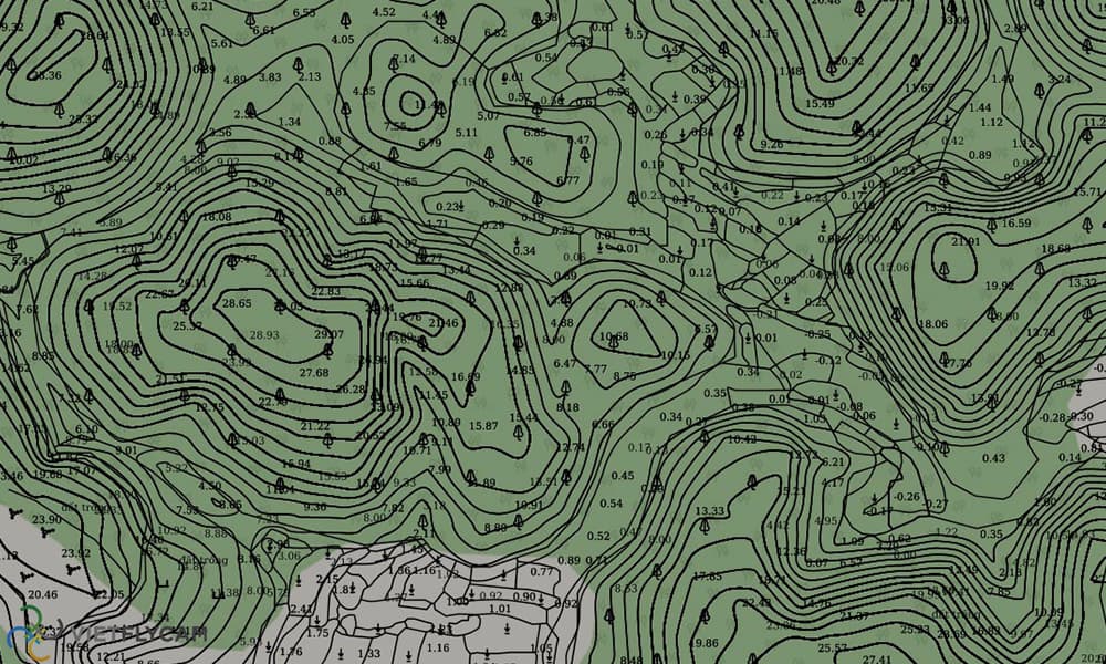
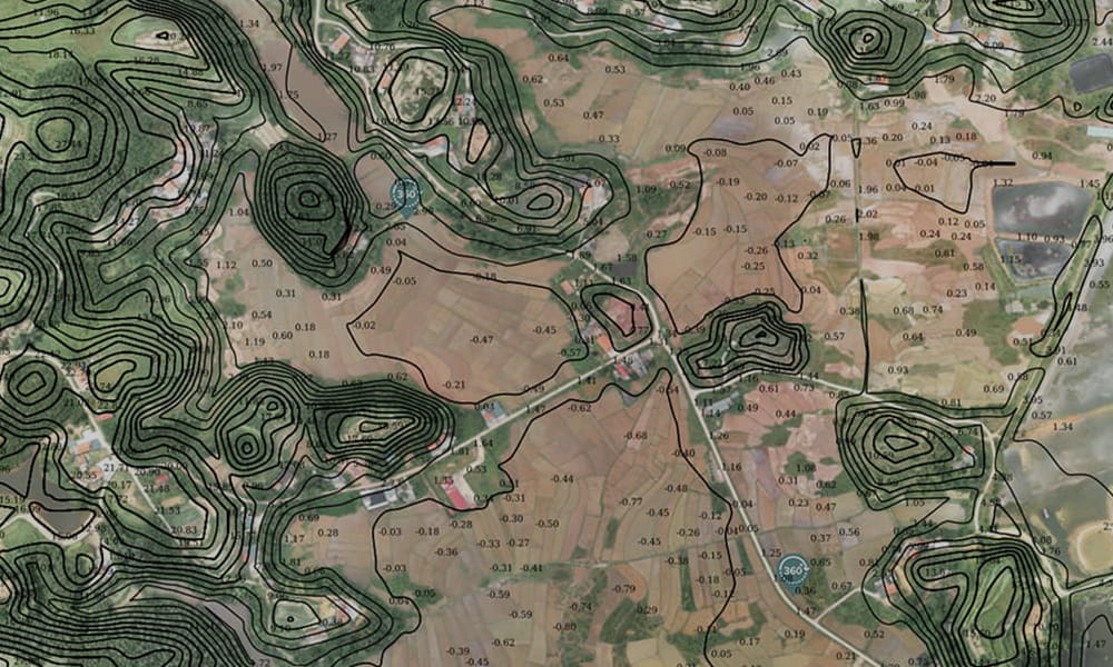
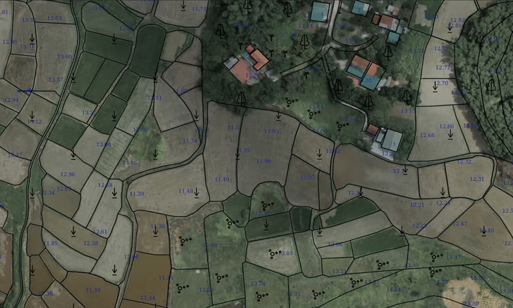
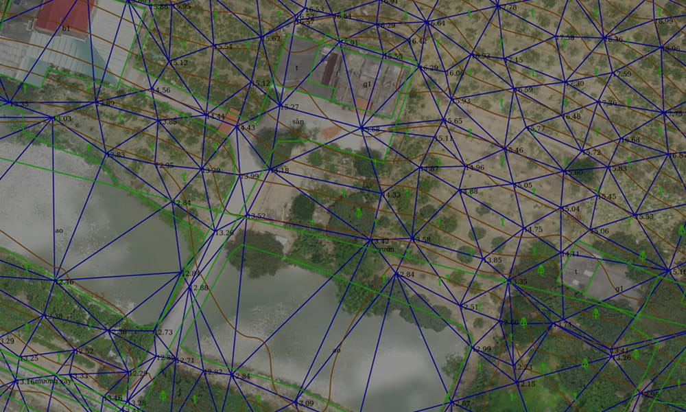
    The largest and only storage and display system for online map data ever deployed in Vietnam.

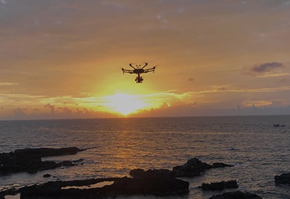
    Highly experienced, professional, and enthusiastic team. Most advanced and high-quality scanning aircraft systems.

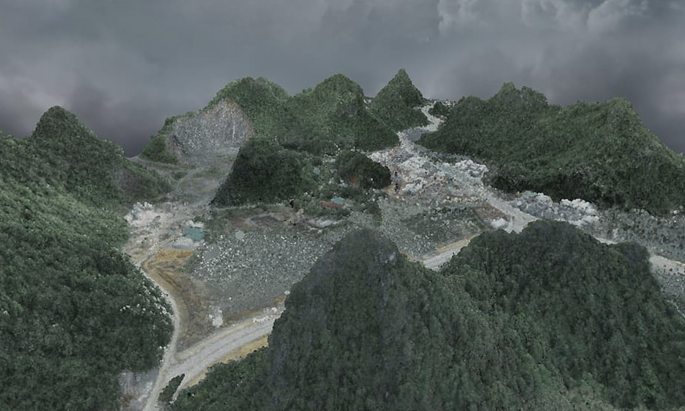
    Visual images of each periodic scan help evaluate construction efficiency and check for errors

    PROJECTS

    PROJECT

    In Vietnam, we have a lot of experience and have cooperated with many big partners during 9 years of operation.

    Mau Son Mountain - Lang Son

    Tien Yen - Quang Ninh

    Ponagar tower - Yen Bai

    CONTACT

    Are you looking for a trusted topography solution?

      giải pháp
      Thành lập bản đồ tỷ lệ 1/500, 1/1000, 1/2000
      1. Biên tập bản đồ địa hình 1/500, 1/2000, 1/5000
      2. Thành lập bản đồ hiện trạng phục vụ quy hoạch, bản đồ địa hình, bản đồ phục nghiên cứu, nuôi trồng.
      3. Số hóa bản đồ, thể hiện trực tuyến bán đồ trên các nền tảng 2D, 3D để phục vụ đánh giá trực quan hiện trạng khu vực khảo sát.
      4. Biên tập chi tiết bản đồ địa hình phục vụ việc thẩm định và cấp phép tại các cơ quan nhà nước.
      Previous
      Next
      call
      zalo
      zalo